Historic Origins of Alabama's Boundaries
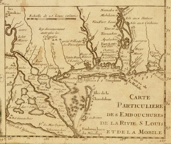 Map of French Louisiana
Alabama’s complex current boundaries embody the rich history of the state. Diverse events from 1663 to 1826 have created these limits, reflecting a wide array of issues and factors. Rivers and other geographic features, evolving cartographic knowledge, Native American traditions, colonial aspirations, national politics, international confrontations and diplomacy, ambitious land speculations, legal and illegal treaties, territorial squabbles, and, ultimately, official negotiations—all played a role in setting its borders with neighboring states. Generally, Alabama‘s northern and southern boundaries originate in the colonial era, its eastern and western boundaries reflect Indian treaties and land cessions and territorial issues, and the state’s southern footprint to the Gulf of Mexico results from deft international diplomacy.
The Northern Boundary
Alabama’s basic boundaries were shaped during North America’s colonial era. In March 1663, King Charles II of England created the Carolina colony from Virginia and set the 31st parallel, now Alabama’s southern boundary with Florida, as the southern limit of Carolina. In 1729, the colonies of North Carolina and South Carolina were formed from the Carolina colony, but no border was set between North Carolina and South Carolina west of the Appalachian Mountains. Later, in 1732, the Georgia colony was created entirely from South Carolina; thus, Alabama ultimately would be formed from Georgia. Finally, in 1735, the North and South Carolina colonies agreed on the 35th parallel as the border between them west of the Appalachians, thus leading to the 35th parallel as the border between western North Carolina, which later became Tennessee, and western Georgia, which later became Alabama and Mississippi.
The Northwestern “Ear”
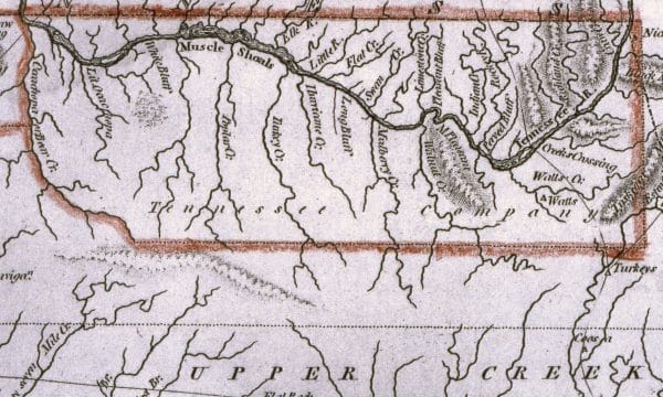 Alabama’s Northwestern “Ear”
The western and eastern limits of Alabama’s northern boundary reflect Native American territorial borders, Georgia’s attempts to sell its western lands, and geographic misunderstanding. For local Indian groups, the Tennessee River was an important natural border. Downstream from Muscle Shoals, it historically separated the Chickasaw Nation to the west from the Cherokee Nation to the east. This traditional Indian boundary is the apparent precedent for the western boundaries of two Georgia land companies of the early federal era.
Georgia entered the union in 1788 as a small coastal state but eagerly claimed vast new western lands extending to the Mississippi River that had been off limits to white settlers under British colonial rule. In 1789, an ambitious Georgia governor began to sell large tracts of this area, culminating in controversial sales in 1795 to four land companies of 35 million acres in present-day Mississippi and Alabama. Involving all kinds of deceit, bribery, and corruption, this debacle, known now as the Yazoo Land Fraud, ended in 1796 when a newly elected Georgia legislature rescinded the fraudulent land sales. Ultimately, Georgia yielded all claims to its former western lands to the federal government in 1802. But the two short-lived Georgia land companies, the 1789 Tennessee Yazoo Company and the 1795 Tennessee Company, apparently determined the limits of Alabama’s north boundary. Their western boundary, going south from the 35th parallel, followed the Tennessee River upriver about nine miles to the mouth of Bear Creek, submerged under present-day Pickwick Lake in the twentieth century. In 1817, this previously recorded land survey feature was the apparent precedent for the Tennessee River part of the border set by Congress between the new state of Mississippi and the Alabama Territory. Thus, Alabama’s “northwest ear,” on the north side of the Tennessee River in the western tip of present-day Lauderdale County, originated from a traditional border between the Chickasaw and Cherokee nations, later followed by the western limits of two ephemeral Georgia land companies.
The Northeastern Corner
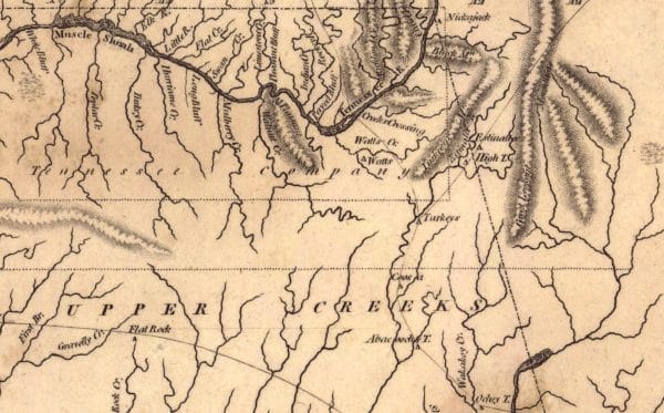 Alabama’s Northeastern Corner
The easternmost limit of Alabama’s northern boundary also derived from Georgia’s 1795 Tennessee Company as well as a mapping error. The described limits of the company’s property began at the mouth of Bear Creek on the Tennessee River, went “up the said creek, to the most southern source thereof,” due east for 120 miles, and due north to the Tennessee River. This description was not accurate, for it assumed that the eastern boundary would intersect the Tennessee River. The southern source of Bear Creek was geographically located further east. Thus, when the eastern boundary was surveyed going north, it did not cross the Tennessee River. Instead, it intersected the company’s northern boundary about three miles east of the Tennessee River, near Nickajack Cave. (This well-known regional landmark is located just south of present-day Nickajack Lake, at the north base of Sand Mountain on which the Alabama, Tennessee, and Georgia boundaries now meet.) Thus, Nickajack came to be identified as the north end of the eastern boundary of the Tennessee Company. Subsequently, Nickajack became the northwestern boundary point of the state of Georgia in 1802 and the northeastern corner of the Mississippi Territory in 1804, the Alabama Territory in 1817, and the state of Alabama in 1819.
The Eastern Boundary—Colonial Origins
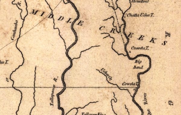 Alabama’s Southeastern Border
The southern part of Alabama’s eastern boundary along the Chattahoochee River originated during the colonial era. Under the 1763 Treaty of Paris, which ended the French and Indian War, the British gained control of all French land in North America east of the Mississippi River. In the Southeast, south of the 31st parallel, the British created the colonies of West Florida and East Florida from former Spanish land. George Johnstone, the first governor of British West Florida, feared that Mobile and Natchez, the region’s major settlements, might lie north of the 31st parallel. So in February 1764, Johnstone had the northern boundary of British West Florida moved about 82 miles north, to a line drawn due east from the mouth of the Yazoo River on the Mississippi River. Located at about 32° 28′ North, this northern boundary line struck the Chattahoochee River near the mouth of Uchee Creek, in present-day Russell County, about three miles east of Fort Mitchell. From that point, West Florida’s eastern boundary followed the Chattahoochee River south to the Gulf of Mexico. Johnstone’s action thus essentially established the southern part of the eastern boundary of Alabama; he would later do the same for Alabama’s western boundary.
The Southern Boundary
The 1783 Treaty of Paris ending the Revolutionary War with Britain set the 31st parallel as the southern boundary of the United States. In that treaty, Britain ceded all land east of the Mississippi River to the new nation and, in a separate treaty, ceded Florida back to Spain. But because boundaries were not clearly defined, Spain and the United States wrangled for years over the northern portion of West Florida. Their 1795 Treaty of San Lorenzo finally set the 31st parallel between the Mississippi and the Chattahoochee rivers as the border between the two nations. This agreement set the stage for creating the Mississippi Territory, from which Alabama would be formed.
The Alabama/Georgia Border
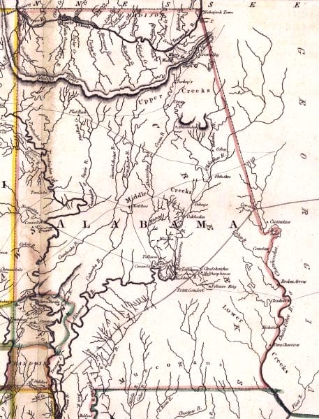 Alabama’s Eastern Border
Alabama’s eastern boundary on the Chattahoochee River and its southern boundary on the 31st parallel resulted from Congress’s creation of the first part of the Mississippi Territory in April 1798. (The Mississippi Territory would later be expanded in 1804 and 1812.) In April 1802, Georgia ceded its western lands to the federal government in a major step toward resolving the legal quagmire resulting from the Yazoo land deals. The Georgia Cession Act established the long diagonal line in Alabama’s eventual northern border with Georgia, describing this line as running from “where a certain creek or river called Uchee … empties into the said Chatahouchie river; thence in a direct line to Nickajack on the Tennessee river….” In 1804, Congress assigned the northern portion of Georgia’s former western land to the Mississippi Territory. In 1826, a joint Alabama-Georgia boundary commission moved the south end of the “Nickajack line” about 40 miles north, from the mouth of Uchee Creek to its current location at Lanett in present-day Chambers County on the Chattahoochee River.
The Gulf Coast “Foot”
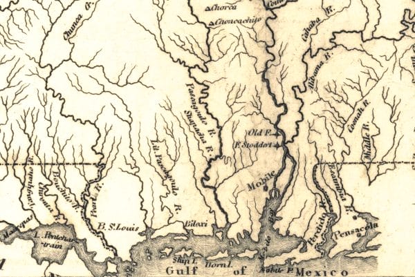 Alabama’s Southern Border
Alabama’s Southern Gulf “foot”—the area south of the 31st parallel and west of the Perdido River—originated from the 1803 Louisiana Purchase, but its history dates back to 1719. At that time, France controlled Mobile Bay and Spain controlled Pensacola Bay just to the east. To resolve disputes over shipping rights and trade, the French commander at New Orleans and the Spanish commander at Pensacola agreed to recognize the Perdido River, a small stream halfway between Mobile and Pensacola, as the border between their respective jurisdictions.
Some 80 years later, in 1803, shrewd American diplomats negotiating the Louisiana Purchase in Paris invoked this informal 1719 agreement as the precedent for setting the Perdido River as the eastern limit of the Louisiana Purchase. Because all of Florida east of the Perdido River remained in Spanish hands until 1819, Florida’s panhandle region did not become part of Alabama. After Louisiana achieved statehood in 1812, Congress added the last eastern remnant of the Louisiana Purchase, between the Pearl River in present-day Mississippi and the Perdido rivers, to the Mississippi Territory. This “Addition of 1812” ultimately became the Gulf “foot” portions of Mississippi and Alabama.
The Western Boundary
 Mississippi-Alabama Border
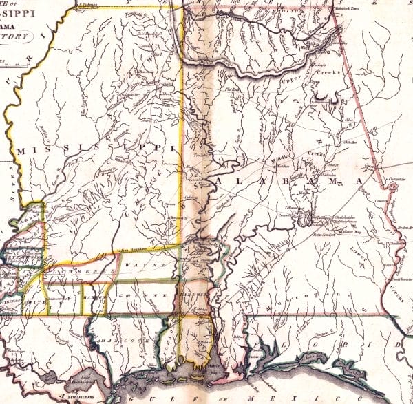
Alabama’s long western border with Mississippi originated from Indian territorial boundaries, a British treaty, Georgia land companies, inaccurate maps, and territorial politics. The westernmost point of the wide angle in the middle of the Alabama-Mississippi border just to the north of present-day Evansboro in Choctaw County is the key factor in creating the line. The west point originated in a 1765 treaty between the British and the Choctaws, negotiated by British West Florida governor George Johnstone. This treaty, which set the Choctaw boundary, separating Indian land to the north from British settlements to the south, led ultimately to the setting of the primary reference point for separating Alabama from Mississippi.
South of the Choctaw boundary line, counties in the Mississippi Territory were formed in 1803. In 1809, the northwest corner of Washington County was fixed as the point where the east-west Choctaw boundary line crossed a prehistoric Indian trail leading north out of Mobile. When Congress created the new state of Mississippi and the Alabama Territory in 1817, the northwest corner of Washington County was used as the primary reference point for setting Mississippi’s eastern boundary. From this point, a line went north to the mouth of Bear Creek on the Tennessee River. South from the point, the bottom leg initially ran due south to the Gulf of Mexico and very close to the east side of Pascagoula Bay. Settlers in this area, however, protested that this vertical boundary placed them in the Alabama Territory, separating them from families and businesses on the west side of Pascagoula Bay. In 1819, when Alabama was admitted to the Union, Congress reunited all the Pascagoula settlers in Mississippi by relocating the bottom leg “to run southeastward from the northwest point of Washington County, to strike the Gulf at a point ten miles east of the mouth of the Pascagoula River.”
Today, the official Great Seal of Alabama recognizes the origins of Alabama’s boundaries in the histories of its neighboring states. The design of the official state seal—conceived by William Wyatt Bibb, first governor of the Alabama Territory—positively affirms this distinction. Unlike most other state seals, Alabama’s features the state’s outline boundary and specifically identifies its neighboring states; Tennessee, Georgia, Florida, and Mississippi.
Further Reading
- Brannon, Peter A. “The Eastern Boundary of Alabama.” In The Pageant Book … in Celebration of Alabama Home Coming Week. Edited by Peter A. Brannon et al., p. 42-48. Montgomery, Ala.: n.p., 1926.
- ———. “The Tennessee State Line: An Historical Interpretation.” Alabama Historical Quarterly 18 (Fall 1956): 412-20.
- ———. “Western Boundary Line of Alabama: A Comment.” Alabama Historical Quarterly 20 (Fall 1958): 571-80.
- Cox, Isaac Joslin. The West Florida Controversy, 1798-1813; A Study in American Diplomacy. 1918. Reprint, Gloucester, Mass.: Baltimore: P. Smith, 1967.
- Hemperley, Marion R., and Edwin L. Jackson. Georgia’s Boundaries: The Shaping of a State. Athens, Ga.: Carl Vinson Institute of Government, University of Georgia, 1993.
- Long, John H., ed. Alabama: Atlas of Historical County Boundaries. New York: Charles Scribner’s Sons, 1996.

