St. Clair County
 St. Clair Courthouse in Asheville
Located in the north-central part of the state, St. Clair County is among Alabama's fastest growing counties and is the only county in Alabama to have two county seats, located in Ashville and Pell City. In 2007, the county was found to have the nation's most extensive natural gas deposits. Its proximity to Jefferson and Shelby Counties has made it attractive to economic and residential development. The county is governed by an elected five-member commission.
St. Clair Courthouse in Asheville
Located in the north-central part of the state, St. Clair County is among Alabama's fastest growing counties and is the only county in Alabama to have two county seats, located in Ashville and Pell City. In 2007, the county was found to have the nation's most extensive natural gas deposits. Its proximity to Jefferson and Shelby Counties has made it attractive to economic and residential development. The county is governed by an elected five-member commission.
- Founding Date: November 20, 1818
- Area: 646 square miles
- Population: 88,929 (2020 Census estimate)
- Major Waterways: Coosa River, Cahaba River
- Major Highways: Interstate 20, Interstate 59, U.S. 231, U.S. 11
- County Seats: Ashville, Pell City
- Largest City: Pell City
History
 Gen. Arthur St. Clair
St. Clair County was created from portions of Shelby County by the Alabama Territorial General Assembly on November 20, 1818. Two years later, part of St. Clair County was used to create Jefferson County. Then, in 1836, a portion of St. Clair was divided to establish Cherokee and DeKalb Counties. After the Civil War, a northeast section of the county was used to create Etowah County, resulting in St. Clair's present boundaries. The county was named in honor of Gen. Arthur St. Clair, who travelled to America from Scotland as an ensign in the British Navy. St. Clair settled in Pennsylvania and became a general in the Continental Army during the American Revolution and president of the Continental Congress. Most of St. Clair County's early settlers came from Tennessee, Virginia, and the Carolinas. Some of the county's earliest settlements and towns were Ashville, Odenville, Riverside, and Springville.
Gen. Arthur St. Clair
St. Clair County was created from portions of Shelby County by the Alabama Territorial General Assembly on November 20, 1818. Two years later, part of St. Clair County was used to create Jefferson County. Then, in 1836, a portion of St. Clair was divided to establish Cherokee and DeKalb Counties. After the Civil War, a northeast section of the county was used to create Etowah County, resulting in St. Clair's present boundaries. The county was named in honor of Gen. Arthur St. Clair, who travelled to America from Scotland as an ensign in the British Navy. St. Clair settled in Pennsylvania and became a general in the Continental Army during the American Revolution and president of the Continental Congress. Most of St. Clair County's early settlers came from Tennessee, Virginia, and the Carolinas. Some of the county's earliest settlements and towns were Ashville, Odenville, Riverside, and Springville.
 St. Clair County Courthouse in Pell City
Ashville, originally called St. Clairsville, served as the first county seat. Ashville was named for John Ash, a senator in the state's first General Assembly. Located in the northern part of St. Clair County, Ashville served as the county's sole county seat from 1821 to 1907. Because Backbone Mountain bisects St. Clair County, many of the county's southern residents had difficulty traveling to Ashville. In 1901, Alabama's newly enacted Constitution provided for Pell City to serve as a judicial seat for the county's Southern District. A constitutional amendment in 1907 established Pell City, named for early settler George H. Pell, as a second county seat. Although both Ashville and Pell City handle county business, the county commission meets in Ashville. St. Clair County is the only county in Alabama to have two county seats.
St. Clair County Courthouse in Pell City
Ashville, originally called St. Clairsville, served as the first county seat. Ashville was named for John Ash, a senator in the state's first General Assembly. Located in the northern part of St. Clair County, Ashville served as the county's sole county seat from 1821 to 1907. Because Backbone Mountain bisects St. Clair County, many of the county's southern residents had difficulty traveling to Ashville. In 1901, Alabama's newly enacted Constitution provided for Pell City to serve as a judicial seat for the county's Southern District. A constitutional amendment in 1907 established Pell City, named for early settler George H. Pell, as a second county seat. Although both Ashville and Pell City handle county business, the county commission meets in Ashville. St. Clair County is the only county in Alabama to have two county seats.
On April 27, 2011, a massive storm, causing numerous powerful tornadoes, struck the southeastern United States. More than 250 people were killed in Alabama, including 16 people in St. Clair County, including one person in Pell City and one person in Moody.
Major Cities and Demographics
 John H. Bankhead Bridge in Riverside
According to 2020 Census estimates, the population of St. Clair County was 88,929. Of that total, 87.0 percent of those respondents identified themselves as white, 9.4 percent as African American, 2.4 percent as Hispanic, 1.4 percent as two or more races, 0.8 percent as Asian, and 0.5 percent as Native American. The largest city in the county is Pell City, one of two county seats, with an estimated population of 14,081. Ashville, the other county seat, has an estimated population of 2,309. Other significant population centers include Moody, Springville, and Steele. The median household income was $62,531, compared with $52,035 for the state as a whole, and the per capita income was $27,941, compared with $28,934 for the state as a whole.
John H. Bankhead Bridge in Riverside
According to 2020 Census estimates, the population of St. Clair County was 88,929. Of that total, 87.0 percent of those respondents identified themselves as white, 9.4 percent as African American, 2.4 percent as Hispanic, 1.4 percent as two or more races, 0.8 percent as Asian, and 0.5 percent as Native American. The largest city in the county is Pell City, one of two county seats, with an estimated population of 14,081. Ashville, the other county seat, has an estimated population of 2,309. Other significant population centers include Moody, Springville, and Steele. The median household income was $62,531, compared with $52,035 for the state as a whole, and the per capita income was $27,941, compared with $28,934 for the state as a whole.
Economy
 Eissmann Automotive Expansion in Pell City
Like most of Alabama's counties, farming was the prevailing occupation of St. Clair County until well into the twentieth century. Corn and cattle were the county's original major agricultural products. By the mid-twentieth century, however, farmers diversified into a variety of other products. Today, beef cattle, hay, tomatoes, poultry, and sod are St. Clair's main agricultural products. As a series of locks and dams made the Coosa River navigable in the mid-twentieth century, the resulting hydroelectric power made possible a number of industries, including lumber and paper mills. By the 1990s, the automotive and aerospace industries had come to St. Clair County. German automotive companies WKW Erbsloeh North America and Eissmann Automotive North America, both in Pell City, are major employers, as is Japanese auto-parts supplier Unipres Corporation in Steele. Longtime employer Avondale Mills closed in July 2006, shutting down a plant in Pell City and laying off scores of workers.
Eissmann Automotive Expansion in Pell City
Like most of Alabama's counties, farming was the prevailing occupation of St. Clair County until well into the twentieth century. Corn and cattle were the county's original major agricultural products. By the mid-twentieth century, however, farmers diversified into a variety of other products. Today, beef cattle, hay, tomatoes, poultry, and sod are St. Clair's main agricultural products. As a series of locks and dams made the Coosa River navigable in the mid-twentieth century, the resulting hydroelectric power made possible a number of industries, including lumber and paper mills. By the 1990s, the automotive and aerospace industries had come to St. Clair County. German automotive companies WKW Erbsloeh North America and Eissmann Automotive North America, both in Pell City, are major employers, as is Japanese auto-parts supplier Unipres Corporation in Steele. Longtime employer Avondale Mills closed in July 2006, shutting down a plant in Pell City and laying off scores of workers.
Employment
According to 2020 Census estimates, the workforce in St. Clair County was divided among the following industrial categories:
- Educational services, and health care and social assistance (19.8 percent)
- Manufacturing (15.6 percent)
- Professional, scientific, management, and administrative and waste management services (10.3 percent)
- Construction (10.1 percent)
- Retail trade (9.4 percent)
- Arts, entertainment, recreation, and accommodation and food services (6.4 percent)
- Transportation and warehousing, and utilities (6.0 percent)
- Other services, except public administration (5.9 percent)
- Wholesale trade (5.1 percent)
- Finance and insurance, and real estate, rental, and leasing (4.7 percent)
- Public administration (4.4 percent)
- Information (1.4 percent)
- Agriculture, forestry, fishing and hunting, and extractive (0.8 percent)
Education
The St. Clair County school system oversees 18 primary and secondary schools. Pell City Schools oversees seven primary and secondary schools. Jefferson State Community College offers interactive video conferencing courses at the St. Clair instructional site in Pell City where students may take courses in education administration or business. Also, the St. Clair County Extension Office of the Alabama Cooperative Extension System offers educational programs in agriculture, forestry, consumer science, and community resource development.
Geography
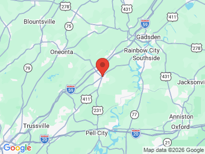
 St. Clair County Map
Encompassing 646 square miles, St. Clair County lies at the southern tip of the Appalachian Mountain Range and is divided by Backbone Mountain. The county is part of the Valley and Ridge physiographic section. The valleys consist of fertile, limestone soils, whereas the ridges consist of acidic, sandstone soils that support wooded areas made up of oak and shortleaf pine trees. St. Clair County is bordered by Etowah and Blount Counties to the north, Jefferson County to the west, Shelby and Talladega Counties to the south, and Calhoun County to the east.
St. Clair County Map
Encompassing 646 square miles, St. Clair County lies at the southern tip of the Appalachian Mountain Range and is divided by Backbone Mountain. The county is part of the Valley and Ridge physiographic section. The valleys consist of fertile, limestone soils, whereas the ridges consist of acidic, sandstone soils that support wooded areas made up of oak and shortleaf pine trees. St. Clair County is bordered by Etowah and Blount Counties to the north, Jefferson County to the west, Shelby and Talladega Counties to the south, and Calhoun County to the east.
The Coosa River runs along the eastern border of the county. Because the Coosa River is one of the most heavily used rivers in the state, much of its biological diversity is restricted to its tributaries, which fan out throughout the eastern half of St. Clair County. A series of locks and dams along the Coosa River provide business and recreational opportunities for the county. In addition, a number of tributaries of the Cahaba River flow throughout the western half of St. Clair County, creating scenic views and recreational opportunities.
Interstates 20 and 59 are the county's major transportation routes. Both interstates run southwest-northeast. U.S. Highway 11 and U.S. Highway 231 are also major transportation routes for St. Clair County. U.S. Highway 11 runs southwest-northeast, whereas U.S. Highway 231 runs north-south through the middle of the county. There are no public airports in St. Clair County.
Events and Places of Interest
 Bluegrass Festival at Horse Pens 40 in Steele
There are numerous recreational options for visitors to St. Clair County. For example, the construction of H. Neely Henry Dam and Logan Martin Dam created a series of lakes, the largest of which is Logan Martin Lake, with 15,263 acres and 273 miles of shoreline. The lakes provide a range of water sports, including fishing, boating, water skiing, sailing, and swimming. Privately owned Horse Pens 40 is an outdoor nature park that sits atop Chandler Mountain in the foothills of the Appalachian Mountains. The 120-acre site contains ancient Indian burial grounds and hosts various cultural events throughout the year, including music festivals, Civil War reenactments, and Native American arts festivals. The Christian-oriented Sumatanga Camp and Conference Center near Ashville and Gallant provides camping and hiking and a 55-acre lake for boating and swimming.
Bluegrass Festival at Horse Pens 40 in Steele
There are numerous recreational options for visitors to St. Clair County. For example, the construction of H. Neely Henry Dam and Logan Martin Dam created a series of lakes, the largest of which is Logan Martin Lake, with 15,263 acres and 273 miles of shoreline. The lakes provide a range of water sports, including fishing, boating, water skiing, sailing, and swimming. Privately owned Horse Pens 40 is an outdoor nature park that sits atop Chandler Mountain in the foothills of the Appalachian Mountains. The 120-acre site contains ancient Indian burial grounds and hosts various cultural events throughout the year, including music festivals, Civil War reenactments, and Native American arts festivals. The Christian-oriented Sumatanga Camp and Conference Center near Ashville and Gallant provides camping and hiking and a 55-acre lake for boating and swimming.

There are a variety of museums located in St. Clair County. The historic St. Clair County Courthouse is the oldest operating courthouse in the state and is the centerpiece of the Ashville Historic District. The John W. Inzer Museum, originally the home of Confederate officer and district judge John Inzer, is a Greek revival home built in 1852 that houses Inzer's papers and memorabilia. Built in 1820, the John Looney Pioneer House Museum may be the oldest dogtrot log house in the state. Known for its pioneer architecture, the museum hosts an annual fall festival with food, games, arts and crafts, and music. In addition, the recently restored Ragland Depot Museum houses railroad history artifacts as well as artifacts from the town of Ragland.
Springville hosts the Homestead Hollow Country Fair and Arts Festival, once each season, showcasing the work of local artists in addition to offering a variety of food and music. White's Mountain Bluegrass Festival is a popular two-day festival featuring local and national bluegrass musicians held each summer and fall in St. Clair Springs.
Additional Resources
- Crow, Mattie Lou Teague. History of St. Clair County, Alabama. Huntsville, Ala.: Strode Publishers, 1973.
- The Heritage of St. Clair County, Alabama. Clanton, Ala.: Heritage Publishing Consultants, 1998.