Daviston
Daviston is located in the extreme northeast corner of Tallapoosa County in the east-central part of the state and is believed to be the first incorporated rural town in the county. It is notable for having a town boundary that forms a square. It has a mayor/city council form of government. Alabama Public Safety Director Floyd Mann, who was in office during the Freedom Rides, was born in Daviston.
History
 Battlefield at Horseshoe Bend
The earliest settlers in the area, according to land purchase records, arrived in 1836, soon after the forced removal of the Creek Indians. It was an attractive area for prospective farmers with fertile creeks and riverbeds and rolling hills. The town was named after its first postmaster, John O. Davis, in 1853. By the 1860s, the town boasted numerous and varied businesses, churches, and stores. The post office closed in 1860 just prior to the start of the Civil War and then reopened in 1872. Daviston incorporated in 1887.
Battlefield at Horseshoe Bend
The earliest settlers in the area, according to land purchase records, arrived in 1836, soon after the forced removal of the Creek Indians. It was an attractive area for prospective farmers with fertile creeks and riverbeds and rolling hills. The town was named after its first postmaster, John O. Davis, in 1853. By the 1860s, the town boasted numerous and varied businesses, churches, and stores. The post office closed in 1860 just prior to the start of the Civil War and then reopened in 1872. Daviston incorporated in 1887.
Daviston College opened in the 1880s and became a high school in 1916. The school burned down in 1923 and burned again during its reconstruction. After the school was finally finished, its doors remained open until 1988. A new post office building was completed in 1976. In 1977, the town limits were expanded by a mile in each direction, more than doubling the size of the town. That same year, Daviston formed its own volunteer fire department when the U.S. Forest Service provided the city with a firetruck. A sewing factory opened in 1989, employing about 110 people, but it closed in 1998.
Demographics
According to 2020 Census estimates, Daviston recorded a population of 207. Of that number, 94.7 percent of respondents identified themselves as white, 3.9 percent as African American, and 1.4 percent as two or more races. The town's median household income was $48,750 and the per capita income was $25,065.
Employment
According to 2020 Census estimates, the workforce in Daviston was divided among the following industrial categories:
- Educational services, and health care and social assistance (21.4 percent)
- Manufacturing (19.0 percent)
- Transportation and warehousing and utilities (15.5 percent)
- Retail trade (13.1 percent)
- Construction (9.5 percent)
- Agriculture, forestry, fishing and hunting, and extractive (6.0 percent)
- Professional, scientific, management, and administrative and waste management services (4.8 percent)
- Public administration (4.8 percent)
- Other services, except public administration (3.6 percent)
- Arts, entertainment, recreation, and accommodation and food services (1.2 percent)
- Wholesale trade (1.2 percent)
Education
Students in Daviston attend Tallapoosa County schools; no public schools are located within the town limits.
Transportation
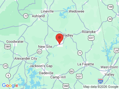
State Highway 22 bisects Daviston running east-west while County Road 79 also runs through the town southwest to the north.
Events and Places of Interest
Daviston is located just north of the Tallapoosa River. Horseshoe Bend National Military Park, which commemorates the site of the Battle of Horseshoe Bend ending the Creek War of 1813-14, is located about five miles southwest of town. The park hosts living history events and has hiking and driving trails that explain the battle as well as picnic facilities.
Additional Resources
- Tallapoosa County Bicentennial Committee. Tallapoosa County: A History. Alexander City, Ala.: Service Printing Company, 1976.
- Tallapoosa County Heritage Book Committee. The Heritage of Tallapoosa County, Alabama. Clanton, Ala.: Heritage Publishing Consultants, 2000.