Phil Campbell
 Phil Campbell Mural
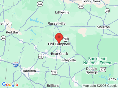
Phil Campbell is located in eastern Franklin County, in northwest Alabama. The town is the home of Billy Sherrill, an influential country music producer and Country Music Hall of Fame member. Phil Campbell suffered devastating damage during the tornado outbreak that struck Alabama in April 2011.
Phil Campbell Mural
Phil Campbell is located in eastern Franklin County, in northwest Alabama. The town is the home of Billy Sherrill, an influential country music producer and Country Music Hall of Fame member. Phil Campbell suffered devastating damage during the tornado outbreak that struck Alabama in April 2011.
History
The town's distinctive name comes from Phil Campbell, a railroad construction superintendent who worked throughout northwest Alabama during the 1880s and 1890s. Campbell oversaw the building of the Sheffield, Birmingham, and Tennessee Railroad (later the North Alabama Railway), an important artery connecting the iron ore mined in the Birmingham District to the blast furnaces under construction in Sheffield. In 1886, as Campbell's team extended the tracks south from Sheffield into Franklin County, he was approached by Mel Allen, the owner of a general store in an unnamed settlement southeast of Russellville. Allen promised Campbell that if he brought the railroad through the young town, the community would be named in his honor. Campbell accepted the offer, and the town was named Phil Campbell. Campbell was manager of the railroad throughout the 1890s and served as mayor of Sheffield from 1893 to 1895.
 John Patterson Campaigning in Phil Campbell
The community benefited from the arrival of the railroad, which brought trains through the town four times daily. However, the population increased slowly; by the time of its incorporation in 1911—15 years after its founding—Phil Campbell had a population of only 300. The town continued to grow steadily throughout the twentieth century. The first school was built in 1911 and a now-defunct newspaper, The Phil Campbell News, was established in 1920.
John Patterson Campaigning in Phil Campbell
The community benefited from the arrival of the railroad, which brought trains through the town four times daily. However, the population increased slowly; by the time of its incorporation in 1911—15 years after its founding—Phil Campbell had a population of only 300. The town continued to grow steadily throughout the twentieth century. The first school was built in 1911 and a now-defunct newspaper, The Phil Campbell News, was established in 1920.
On April 27, 2011, an EF-5 tornado with 210 mph winds ravaged Phil Campbell after touching down in northeastern Marion County, then winding its way into Franklin County and directly through the town. In the wake of the disaster, National Weather Survey crews noted extensive damage from the intersection of County Road 51 and Alabama Highway 237 to the intersection of County Road 81 and County Road 75. The tornado killed 28 people in the vicinity of Phil Campbell and destroyed nearly a third of residents' homes. Property damage was estimated at $119 million.
Demographics
According to 2020 Census estimates, Phil Campbell recorded a population of 935. Of that number, 89.7 percent of respondents identified themselves as white, 1.9 percent as African American, 7.8 percent as Hispanic, and 3.2 percent as two or more races. The town's median household income was $29,375, and the per capita income was $15,519.
Employment
According to 2020 Census estimates, the workforce in Phil Campbell was divided among the following industrial categories:
- Manufacturing (28.3 percent)
- Educational services and health care and social assistance (23.9 percent)
- Other services, except public administration (8.0 percent)
- Arts, entertainment, and recreation, and accommodation and food services (7.2 percent)
- Transportation and warehousing, and utilities (7.2 percent)
- Public administration (6.8 percent)
- Retail trade (6.8 percent)
- Wholesale trade (5.6 percent)
- Construction (4.8 percent)
- Finance and insurance, and real estate and rental and leasing (1.2 percent)
- Professional, scientific, and management, and administrative and waste management services (0.4 percent)
Education
Phil Campbell is served by Franklin County Schools and has one elementary school and one high school. A branch campus of Northwest Shoals Community College offers academic programs, technical training, and other student and community services.
Transportation
Phil Campbell is bisected by State Highway 13/5, which runs north-south. To the north, State Highway 13/5 joins U.S. Highway 43, which connects Phil Campbell to Russellville, the seat of Franklin County, and Hamilton, the seat of Marion County. To the south, State Highway 13/5 connects the town to Haleyville, the largest city in Winston County. Russellville Municipal Airport is located 9 miles north of Phil Campbell via State Highway 243.
Events and Places of Interest
 Rainbow Falls in Dismals Canyon
In 1995, writer Phil Campbell, from New York City, organized a Phil Campbell Convention in the town. Around 20 people from across the country named Phil or Phyllis Campbell attended. Over the next few years, the event transformed into an annual Downtown Hoedown held in the spring or summer. In June 2011, after the devastation of the April tornado, Phil Campbell once again welcomed people named Phil Campbell—this time from all over the world—to participate in the combined Downtown Hoedown and Phil Campbell Convention. In addition to its usual activities, the event included fundraisers that contributed to the community's post-tornado relief efforts.
Rainbow Falls in Dismals Canyon
In 1995, writer Phil Campbell, from New York City, organized a Phil Campbell Convention in the town. Around 20 people from across the country named Phil or Phyllis Campbell attended. Over the next few years, the event transformed into an annual Downtown Hoedown held in the spring or summer. In June 2011, after the devastation of the April tornado, Phil Campbell once again welcomed people named Phil Campbell—this time from all over the world—to participate in the combined Downtown Hoedown and Phil Campbell Convention. In addition to its usual activities, the event included fundraisers that contributed to the community's post-tornado relief efforts.
Dismals Canyon, a natural sandstone gorge designated as a National Natural Landmark, is located approximately six miles west of Phil Campbell on Highway 8. The privately owned canyon is notable as a haven for North America's largest-known population of Orfelia fultoni—a species of fungus gnat whose larvae emit a bioluminescent glow. Dismals Canyon also purportedly provided a hiding place for outlaws, including prominent fugitives Aaron Burr and Jesse James.
Additional Resources
- The Heritage of Franklin County, Alabama. Clanton, Ala.: Heritage Publishing Consultants, 1999.