Hokes Bluff
Hokes Bluff is located on a high bluff overlooking the Coosa River in southeast Etowah County in the northeast part of the state. Notable Civil War figure John Henry Wisdom resided in Hokes Bluff during the latter part of his life until his death in 1909. He was described as the "Paul Revere of the Confederacy" for his ride from Gadsden to Rome, Georgia, to warn its inhabitants of a federal raiding party led by Col. Abel D. Streight.
History
 Pollard's Cotton Gin, 1928
The area on which Hokes Bluff now stands was originally Cherokee territory; when the Cherokee were forced from their land in 1836, it was opened for white settlers. "The Bluff," as the area overlooking the Coosa River was then called, was a staging area for sending the Cherokee downstream to Gunters Landing (now Guntersville) on the first leg of their forced march to present-day Oklahoma.
Pollard's Cotton Gin, 1928
The area on which Hokes Bluff now stands was originally Cherokee territory; when the Cherokee were forced from their land in 1836, it was opened for white settlers. "The Bluff," as the area overlooking the Coosa River was then called, was a staging area for sending the Cherokee downstream to Gunters Landing (now Guntersville) on the first leg of their forced march to present-day Oklahoma.
Settlers began coming into the area in the 1830s, including the man after whom the town was eventually named, Daniel Hoke, a local entrepreneur who built a trading post, store, and blacksmith shop. The settlement soon became known as "Hoke's Bluff," with the apostrophe being dropped at some point.
During the Civil War, many locals tried to remain neutral in the conflict, but the town suffered repeated raids from both U.S. Army and Confederate forces. As with much of the South, Hokes Bluff suffered economically because of the war and during Reconstruction. The town remained a small, unincorporated area until 1946, when it officially incorporated. Public water followed in 1949, and municipal gas in 1953. A city hall complex was built in 1971, followed in 1986 by a separate building to house the police department and the volunteer fire department.
Demographics
According to 2020 Census estimates, Hokes Bluff recorded a population of 4,253. Of that number, 99.1 percent identified themselves as white, 2.1 percent as Hispanic or Latino, and 0.9 percent as two or more races. The city's median household income was $53,920, and the per capita income was $31,335.
Employment
According to 2020 Census estimates, the workforce in Hokes Bluff was divided among the following industrial categories:
- Educational services, and health care and social assistance (22.2 percent)
- Construction (18.7 percent)
- Other services, except public administration (12.6 percent)
- Public administration (12.2 percent)
- Manufacturing (11.3 percent)
- Professional, scientific, management, and administrative and waste management services (6.6 percent)
- Arts, entertainment, recreation, and accommodation and food services (5.0 percent)
- Information (4.7 percent)
- Wholesale trade (2.3 percent)
- Finance, insurance, and real estate, rental, and leasing (1.9 percent)
- Transportation and warehousing and utilities (1.3 percent)
- Retail trade (1.0 percent)
Education
Schools in Hokes Bluff are part of the Etowah County School system; the town has one elementary school, one middle school, and one high school. Gadsden State Community College is located eight miles from town, and Jacksonville State University is located less than 15 miles away.
Transportation
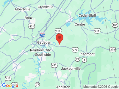
County Highway 71 runs east-west through Hokes Bluff and County Highway 65 runs north-south through the town; U.S. Highway 278 runs east-west just south of the city. The closest airport to Hokes Bluff is the Northeast Alabama Regional Airport, approximately 16 miles to the west.
Events and Places of Interest
Hokes Bluff has one city park that features a pavilion and a walking trail. The city also has a municipal pool and a community center with space that can be rented for private events.
Additional Resources
- Etowah County Heritage Book Committee. Heritage of Etowah County. Clanton, Ala.: Heritage Publishing Consultants, 1999.
- Etowah County Centennial Commission. A History of Etowah County, Alabama. Birmingham: Roberts and Son, 1968.