Uniontown
 Westwood Plantation in Uniontown
Uniontown is located in western Perry County in west-central Alabama. It has a mayor-city council form of government. International professional basketball player Erwin Dudley was born in Uniontown and played for the University of Alabama Crimson Tide from 1999 to 2003. Artist Frances de la Rosa was also born and raised in the city.
Westwood Plantation in Uniontown
Uniontown is located in western Perry County in west-central Alabama. It has a mayor-city council form of government. International professional basketball player Erwin Dudley was born in Uniontown and played for the University of Alabama Crimson Tide from 1999 to 2003. Artist Frances de la Rosa was also born and raised in the city.
History
First settled in 1818, the area that would become Uniontown was initially called Woodville after the first family that settled there; the town was incorporated in 1836. Woodville was the terminus of one of the earliest plank roads (a road literally paved with wooden planks) in the state, which was constructed in 1848 and connected Woodville with Demopolis. The Alabama and Mississippi Railroad came through the town in 1857. By 1860, the town had expanded enough to support educational facilities for both boys and girls. In addition to the schools, the town had a number of businesses on its main street, including two department stores, and the town's economy was tied closely to the surrounding plantations. The town became known as Uniontown in 1861 at the suggestion of a local planter, Philip Weaver, whose hometown was Uniontown, Maryland. During the Civil War, Uniontown sent a number of men to fight with the Canebrake Rifle Guards, a unit named after the geographical region in which Uniontown is located, as well as in another unit known as the Independent Troop of Uniontown.
 Pitts' Folly in Uniontown, 1936
The area remained tied to the agricultural economy after the war. In 1897, the Uniontown Cotton Oil Company was established in the town, one of the first facilities of its kind in the state and one of the first industrial businesses in Perry County; it manufactured cotton seed oil and cotton seed meal. By 1900, the town had cotton gins, cotton warehouses, and a cotton mill. The city also had electricity and telephone services by this time. Less than two decades later, however, Uniontown began to lose population as more people abandoned plantations, largely because of the boll weevil's ruinous effect on the cotton crop.
Pitts' Folly in Uniontown, 1936
The area remained tied to the agricultural economy after the war. In 1897, the Uniontown Cotton Oil Company was established in the town, one of the first facilities of its kind in the state and one of the first industrial businesses in Perry County; it manufactured cotton seed oil and cotton seed meal. By 1900, the town had cotton gins, cotton warehouses, and a cotton mill. The city also had electricity and telephone services by this time. Less than two decades later, however, Uniontown began to lose population as more people abandoned plantations, largely because of the boll weevil's ruinous effect on the cotton crop.
Demographics
According to 2020 Census estimates, Uniontown recorded a population of 1,918. Of that number, 97.8 percent of respondents identified themselves as African American, 1.6 percent as white, and 0.2 as two or more races. The town's median household income was $19,408, and the per capita income was $12,493.
Employment
According to 2020 Census estimates, the workforce in Uniontown was divided among the following industrial categories:
- Other services, except public administration (20.3 percent)
- Educational services and health care and social assistance (17.4 percent)
- Construction (14.6 percent)
- Manufacturing (13.9 percent)
- Professional, scientific, and management, and administrative and waste management services (11.1 percent)
- Public administration (10.0 percent)
- Transportation and warehousing, and utilities (7.2 percent)
- Arts, entertainment, and recreation, and accommodation and food services (4.1 percent)
- Finance and insurance, and real estate and rental and leasing (1.8 percent)
- Retail trade (1.3 percent)
Education
Schools in Uniontown are part of the Perry County School District; the town has one elementary school and one high school.
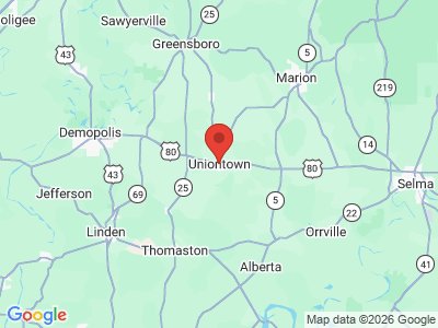
Transportation
U.S. Highway 80 runs east-west through Uniontown, and County Roads 53, 1, and 12 all run to the city. The closest major airport is Montgomery Regional Airport, 66 miles to the east.
Events and Places of Interest
The Uniontown Historic District, Pitts' Folly (a Greek Revival house built in 1852), the Westwood Plantation (built between 1836 and 1850), and the Fairhope Plantation (a Gothic-style house built in the 1850s) are all listed on the National Register of Historic Places.
Additional Resources
- Perry County Heritage Book Committee. The Heritage of Perry County, Alabama. Clanton, Ala: Heritage Publishing Consultants, 1999.