Greene County
 Bird's Farm Sculptures
Located in west-central Alabama in the Black Belt, Greene County is home to an impressive 39 historic structures and the annual Black Belt Roots Festival. The Sipsey River Swamp offers visitors natural beauty and many outdoor-sporting opportunities. During the nineteenth century, the county seat, Eutaw, was the hub of mercantile and legal administration for the Black Belt. The county is governed by an elected five-member commission and includes three incorporated communities.
Bird's Farm Sculptures
Located in west-central Alabama in the Black Belt, Greene County is home to an impressive 39 historic structures and the annual Black Belt Roots Festival. The Sipsey River Swamp offers visitors natural beauty and many outdoor-sporting opportunities. During the nineteenth century, the county seat, Eutaw, was the hub of mercantile and legal administration for the Black Belt. The county is governed by an elected five-member commission and includes three incorporated communities.
- Founding Date: December 13, 1819
- Area: 631 square miles
- Population: 8,221 (2020 Census estimate)
- Major Waterways: Tombigbee River, Black Warrior River
- Major Highways: Interstate 59, U.S. 43, U.S. 11
- County Seat: Eutaw
- Largest City: Eutaw
History
 Nathanael Greene
Greene County was created by an act of the Alabama Territorial Legislature on December 13, 1819, from lands ceded to the federal government by the Choctaw in the 1816 Treaty of Fort St. Stephens. The county was named for Revolutionary War hero Nathaniel Greene, and the county seat, Eutaw, was named for the Battle of Eutaw Springs, in which Greene led his troops in the recapture of Charleston, South Carolina, from the British. In 1867, sections of Greene County were used to form Hale County. The first county seat was located at Erie, located on the banks of the Black Warrior River in what is now Hale County. As a result of flooding and the prevalence of yellow fever, the county seat was moved to the more central location of Eutaw in 1838. In the decades leading up to the Civil War, Eutaw experienced a golden era as the mercantile and legal center of the Black Belt. The first courthouse, built in 1838, burned in 1868. The current courthouse was built in 1993.
Nathanael Greene
Greene County was created by an act of the Alabama Territorial Legislature on December 13, 1819, from lands ceded to the federal government by the Choctaw in the 1816 Treaty of Fort St. Stephens. The county was named for Revolutionary War hero Nathaniel Greene, and the county seat, Eutaw, was named for the Battle of Eutaw Springs, in which Greene led his troops in the recapture of Charleston, South Carolina, from the British. In 1867, sections of Greene County were used to form Hale County. The first county seat was located at Erie, located on the banks of the Black Warrior River in what is now Hale County. As a result of flooding and the prevalence of yellow fever, the county seat was moved to the more central location of Eutaw in 1838. In the decades leading up to the Civil War, Eutaw experienced a golden era as the mercantile and legal center of the Black Belt. The first courthouse, built in 1838, burned in 1868. The current courthouse was built in 1993.
 Tenant Farmers Hoeing a Cotton Field
During the Mexican War, Eutaw contributed a company of volunteers. Known as the Eutaw Rangers, the company mustered out of Mobile in June 1846 and participated in the Battle of Vera Cruz. During the Civil War, prominent Eutaw lawyer Stephen Fowler Hale was appointed by Gov. Andrew B. Moore as Alabama's secession commissioner. Hale travelled to Kentucky in an effort to convince the border state to secede and join the Confederacy and later served his district in the Confederate Congress. He was killed at the Battle of Gaine's Mill in 1862. In the years following the Civil War, Greene County experienced a steady decline, and by the twentieth century it had become one of the poorest counties in the state. The vast majority of workers were employed as sharecroppers. During the civil rights movement, African American citizens picketed and boycotted Eutaw businesses. In 1970, the county received statewide media attention when the white-dominated Greene County Board of Education and city council was replaced with an African American majority. In addition, the county elected an African American probate judge and sheriff.
Tenant Farmers Hoeing a Cotton Field
During the Mexican War, Eutaw contributed a company of volunteers. Known as the Eutaw Rangers, the company mustered out of Mobile in June 1846 and participated in the Battle of Vera Cruz. During the Civil War, prominent Eutaw lawyer Stephen Fowler Hale was appointed by Gov. Andrew B. Moore as Alabama's secession commissioner. Hale travelled to Kentucky in an effort to convince the border state to secede and join the Confederacy and later served his district in the Confederate Congress. He was killed at the Battle of Gaine's Mill in 1862. In the years following the Civil War, Greene County experienced a steady decline, and by the twentieth century it had become one of the poorest counties in the state. The vast majority of workers were employed as sharecroppers. During the civil rights movement, African American citizens picketed and boycotted Eutaw businesses. In 1970, the county received statewide media attention when the white-dominated Greene County Board of Education and city council was replaced with an African American majority. In addition, the county elected an African American probate judge and sheriff.
Major Cities and Demographics
 Greene County Courthouse
According to 2020 Census estimates, Greene County recorded a population of 8,221. Approximately 78.9 percent of respondents identified themselves as African American, 17.4 percent as white, 2.7 percent as Hispanic, 2.7 percent as two or more races, and 0.5 percent as American Indian. The county seat, Eutaw, had an estimated population of 2,643. Other population centers in the county include Forkland, Boligee, and Union. The median household income was $26,688, compared with $52,035 for the state as a whole, and the per capita income was $16,425, compared with $28,934 for the state as a whole.
Greene County Courthouse
According to 2020 Census estimates, Greene County recorded a population of 8,221. Approximately 78.9 percent of respondents identified themselves as African American, 17.4 percent as white, 2.7 percent as Hispanic, 2.7 percent as two or more races, and 0.5 percent as American Indian. The county seat, Eutaw, had an estimated population of 2,643. Other population centers in the county include Forkland, Boligee, and Union. The median household income was $26,688, compared with $52,035 for the state as a whole, and the per capita income was $16,425, compared with $28,934 for the state as a whole.
Economy
 Kirkwood Mansion in Eutaw
Because of its location in the fertile Black Belt, Greene County was an agricultural powerhouse during the nineteenth century. When Hale County was created in 1867, however, Greene County lost more than 40 percent of its land, causing its prominence and population to decline. In addition, the mechanization of cotton culture also took a major toll on the county's population, as sharecroppers were replaced by machinery. In 1867, the Alabama Great Southern Railroad lines were built and later the Frisco Railroad constructed lines through the county. The rail lines are now operated by the Norfolk Southern and Burlington Railroads. Major agricultural crops in the county today include beef cattle, catfish, timber, cotton, soybeans, corn, and pond-raised shrimp.
Kirkwood Mansion in Eutaw
Because of its location in the fertile Black Belt, Greene County was an agricultural powerhouse during the nineteenth century. When Hale County was created in 1867, however, Greene County lost more than 40 percent of its land, causing its prominence and population to decline. In addition, the mechanization of cotton culture also took a major toll on the county's population, as sharecroppers were replaced by machinery. In 1867, the Alabama Great Southern Railroad lines were built and later the Frisco Railroad constructed lines through the county. The rail lines are now operated by the Norfolk Southern and Burlington Railroads. Major agricultural crops in the county today include beef cattle, catfish, timber, cotton, soybeans, corn, and pond-raised shrimp.
According to 2020 Census estimates, the workforce in Greene County was divided among the following industrial categories:
- Manufacturing (26.7 percent)
- Educational services, and health care and social assistance (21.2 percent)
- Public administration (14.9 percent)
- Finance and insurance, and real estate, rental, and leasing (7.3 percent)
- Retail trade (7.3 percent)
- Arts, entertainment, recreation, and accommodation and food services (6.3 percent)
- Professional, scientific, management, and administrative and waste management services (5.2 percent)
- Construction (4.7 percent)
- Agriculture, forestry, fishing and hunting, and extractive (2.5 percent)
- Transportation and warehousing, and utilities (2.5 percent)
- Information (0.7 percent)
- Other services, except public administration (0.6 percent)
- Retail trade (0.1 percent)
Education
The Greene County School System oversees five schools. In addition, the county contains one private school.
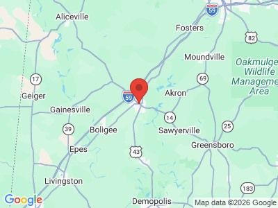
Geography
 Greene County Map
Comprising approximately 631 square miles, Greene County lies in the west-central area of the state, wholly within the Coastal Plain physiographic section. It is bounded to the north by Pickens and Tuscaloosa Counties, to the east by Hale County, to the south by Marengo County, and to the west by Sumter County.
Greene County Map
Comprising approximately 631 square miles, Greene County lies in the west-central area of the state, wholly within the Coastal Plain physiographic section. It is bounded to the north by Pickens and Tuscaloosa Counties, to the east by Hale County, to the south by Marengo County, and to the west by Sumter County.
The Tombigbee River flows along the western border of the county, and its tributary, the Sipsey River Swamp flows along the northern border. Other tributaries of the Tombigbee, including Taylor, Brush, and Trussells creeks, also intersect the county. The Black Warrior River runs along the eastern border until it meets the Tombigbee at Demopolis, just below the southern tip of Greene County, in Marengo County. In 1958, the Warrior Dam was constructed on the Warrior River and created a cut-off canal across the neck of a horseshoe bend in the river. The canal leads barges to a separate lock about three-fourths of a mile southeast of the dam. Interstate 59, running east-west through the county, is the area's major transportation route. U.S. 43, running north-south, and U.S. 11, running east-west, are the county's other transportation routes. Eutaw Municipal Airport is the county's only public airport.
Events and Places of Interest
 Mabel Means and Pine Needle Baskets
Warrior Reservoir, an 8,580-acre lake on the Warrior River, offers crappie, bream, largemouth bass, and striped bass fishing as well as primitive camping, hunting, and boating. The Tombigbee River also offers boating and fishing, and its tributary Sipsey River Swamp offers canoers more than 50,000 acres of bottomland hardwood wetlands. Greene County also has 39 historic structures listed on the National Register of Historic Places, including Kirkwood, a Greek Revival mansion constructed in 1860. Every October, the Greene County Historical Society hosts the Eutaw Pilgrimage, which features a tour of antebellum homes, churches, and the historic Courthouse Square. In August, the town of Eutaw hosts the annual Black Belt Roots Festival, which features live blues and gospel music, crafts, handmade quilts, and food. Bird's Farm, home of late folk artist Jim Bird on Highway 43 in Forkland, features fanciful sculptures made from hay bales, scrap metal, and other found objects.
Mabel Means and Pine Needle Baskets
Warrior Reservoir, an 8,580-acre lake on the Warrior River, offers crappie, bream, largemouth bass, and striped bass fishing as well as primitive camping, hunting, and boating. The Tombigbee River also offers boating and fishing, and its tributary Sipsey River Swamp offers canoers more than 50,000 acres of bottomland hardwood wetlands. Greene County also has 39 historic structures listed on the National Register of Historic Places, including Kirkwood, a Greek Revival mansion constructed in 1860. Every October, the Greene County Historical Society hosts the Eutaw Pilgrimage, which features a tour of antebellum homes, churches, and the historic Courthouse Square. In August, the town of Eutaw hosts the annual Black Belt Roots Festival, which features live blues and gospel music, crafts, handmade quilts, and food. Bird's Farm, home of late folk artist Jim Bird on Highway 43 in Forkland, features fanciful sculptures made from hay bales, scrap metal, and other found objects.
Additional Resources
- Heritage of Greene County, Alabama. Clanton, Ala.: Heritage Publishing Consultants, Inc., 2001.