Coosa County

Located in east-central Alabama, Coosa County is home to several recreational water resources, including Lay Lake, Lake Martin, and Mitchell Lake. During the late twentieth century, the county was a center of the textile industry. The county is governed by an elected five-member commission and includes three incorporated communities.
- Founding Date: December 18, 1832
- Area: 657 square miles
- Population: 10,696 (2020 Census estimate)
- Major Waterways: Coosa River
- Major Highways: U.S. 280, U.S. 231
- County Seat: Rockford
- Largest City: Goodwater
History
 Coosa County Courthouse
Coosa County was created by an act of the Alabama State Legislature on December 18, 1832. The county was one of 14 counties organized from lands ceded by the Creek Indians in the 1832 Treaty of Cusseta. A site on Hatchet Creek was chosen as the county seat and given the name Lexington. In 1835, the name was changed to Rockford. The first railroad, the Central Railway of Georgia, was completed in 1888 at the town of Goodwater. The Coosa River has long played an important part in the history of the county. In 1914, the Alabama Power Company constructed Lay Dam on the Coosa River, creating Lay Lake in the northwestern corner of the county. In 1920, Alabama Power built Mitchell Dam on the Coosa, creating Mitchell Lake. In 1926, Alabama Power Company constructed the Thomas W. Martin Dam on the Tallapoosa River, resulting in the formation of Lake Martin, a portion of which lies in the southeastern corner of the county.
Coosa County Courthouse
Coosa County was created by an act of the Alabama State Legislature on December 18, 1832. The county was one of 14 counties organized from lands ceded by the Creek Indians in the 1832 Treaty of Cusseta. A site on Hatchet Creek was chosen as the county seat and given the name Lexington. In 1835, the name was changed to Rockford. The first railroad, the Central Railway of Georgia, was completed in 1888 at the town of Goodwater. The Coosa River has long played an important part in the history of the county. In 1914, the Alabama Power Company constructed Lay Dam on the Coosa River, creating Lay Lake in the northwestern corner of the county. In 1920, Alabama Power built Mitchell Dam on the Coosa, creating Mitchell Lake. In 1926, Alabama Power Company constructed the Thomas W. Martin Dam on the Tallapoosa River, resulting in the formation of Lake Martin, a portion of which lies in the southeastern corner of the county.
Major Cities and Demographics
According to 2020 Census estimates, Coosa County recorded a population of 10,696. Approximately 65.9 percent of respondents identified themselves as white, 32.3 percent as African American, 1.3 percent as Hispanic, 0.9 percent as two or more races, and 0.3 as Native American. The county seat, Rockford, had an estimated population of 886. The only other significant population center in the county is Goodwater. The median household income was $43,751, as compared with $52,035 for the state as a whole, and the per capita income was $25,083, compared with $28,934 for the state as a whole.
Economy
 Old Goodwater Train Depot
Prior to the Civil War, cotton was the major agricultural product in Coosa County. During the late nineteenth century, however, farmers were forced to diversify turned to raising livestock as well as corn, wheat, and oats as supplemental crops. Given the county's many waterways, gristmills were a popular entrepreneurial endeavor. In 1874, the Central Railway of Georgia ran a spur to Goodwater, and the town became the commercial center of Coosa County. A line from Goodwater to Birmingham was completed in 1888, linking the town to the industrial and commercial hub of Alabama.
Old Goodwater Train Depot
Prior to the Civil War, cotton was the major agricultural product in Coosa County. During the late nineteenth century, however, farmers were forced to diversify turned to raising livestock as well as corn, wheat, and oats as supplemental crops. Given the county's many waterways, gristmills were a popular entrepreneurial endeavor. In 1874, the Central Railway of Georgia ran a spur to Goodwater, and the town became the commercial center of Coosa County. A line from Goodwater to Birmingham was completed in 1888, linking the town to the industrial and commercial hub of Alabama.
In 1966, textile manufacturer Avondale Mills opened a plant in Coosa County, providing the county with several hundred jobs in its spinning facilities. In 1999, the plant employed 350 workers and was producing 350,000 pounds of yarn per year. In May 2006, Avondale Mills announced plans to close its Coosa County plant. Madix Inc., a manufacturer of office and store fixtures, partitions, and shelving, constructed a plant in Goodwater in the 1990s. Other business include Sterling Lumber Company, a sawmill and planing company, and Wingfield Engineering, a custom controls manufacturer and fabricator company.
Employment
According to 2020 Census estimates, the workforce in Coosa County was divided among the following industrial categories:
- Manufacturing (21.7 percent)
- Educational services, and health care and social assistance (19.9 percent)
- Retail trade (14.0 percent)
- Construction (8.4 percent)
- Arts, entertainment, recreation, and accommodation and food services (7.0 percent)
- Transportation and warehousing, and utilities (6.8 percent)
- Other services, except public administration (5.2 percent)
- Public administration (5.1 percent)
- Professional, scientific, management, and administrative and waste management services (3.9 percent)
- Finance and insurance, and real estate, rental, and leasing (3.4 percent)
- Agriculture, forestry, fishing and hunting, and extractive (2.1 percent)
- Wholesale trade (1.8 percent)
- Information (0.7 percent)
Education
The Coosa County School System oversees six schools.
Geography
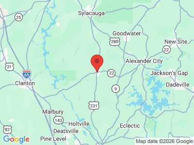
 Coosa County Map
Encompassing approximately 657 square miles, Coosa County lies wholly within the Piedmont physiographic section. It is bounded to the north by Talladega and Clay Counties, to the east by Tallapoosa County, to the south by Elmore County, and to the west by Chilton and Shelby Counties.
Coosa County Map
Encompassing approximately 657 square miles, Coosa County lies wholly within the Piedmont physiographic section. It is bounded to the north by Talladega and Clay Counties, to the east by Tallapoosa County, to the south by Elmore County, and to the west by Chilton and Shelby Counties.
The Coosa River runs along the western border of the county, and several of its tributaries cross the county. The county's major transportation routes are U.S. 280, which runs north-south in the northeastern corner of the county, and U.S. 231, which runs north-south through the center of the county. Coosa County Airport in Goodwater is the county's only public airport.
Events and Places of Interest

Five Star Plantation in Kellyton is a commercial 5,000-acre hunting reserve specializing in deer, turkey, and quail. The county's lakes offer some of the best fishing in the state, including spotted, striped, and largemouth bass, crappie, bream, and catfish, and host several fishing tournaments. Old Rock Jail (ca. 1825) in Rockford is listed on the National Register of Historic Places as the oldest jail in Alabama. Weogufka State Forest is a 240-acre reserve that features several cabins and a stone tower built by the Civilian Conservation Corps and offers hiking, camping, and birding. It is a stop on the Alabama Piedmont Plateau Birding Trail.
Additional Resources
- Brewer, George. History of Coosa County, Alabama. Easley, S.C.: Southern Historical Press, 1987.
- Heritage of Coosa County, Alabama. Clanton, Ala.: Heritage Publishing Consultants, Inc., 1999.