Cherokee County
 Little River Falls
Named for the Cherokee Indians who once controlled much of this part of north Alabama, Cherokee County is home to Weiss Lake and Little River Canyon, two of the most popular outdoor attractions in Alabama. During the Civil War, Cherokee County was a center of iron manufacturing. The county is run by an elected five-member commission.
Little River Falls
Named for the Cherokee Indians who once controlled much of this part of north Alabama, Cherokee County is home to Weiss Lake and Little River Canyon, two of the most popular outdoor attractions in Alabama. During the Civil War, Cherokee County was a center of iron manufacturing. The county is run by an elected five-member commission.
- Founding Date: January 9, 1836
- Area: 553 square miles
- Population: 26,035 (2020 Census estimate)
- Major Waterways: Coosa River, Little River, Weiss Lake
- Major Highways: U.S. 411, U.S. 278
- County Seat: Centre
- Largest City: Centre
History
 Cherokee County Courthouse
Cherokee County was created by an act of the state legislature on January 9, 1836, and was named for the Cherokee Indians who controlled the territory until the early nineteenth century. The famous Cherokee chief Pathkiller, who led the Cherokee in the Creek War of 1813-14, lived in Turkeytown, near the present-day town of Centre. The Cherokee ceded the land that is now Cherokee County in the Treaty of New Echota in 1835. In 1836, newly arrived settlers founded the town of Cedar Bluff, which became the county seat, but in 1844 the county seat was moved to the more centrally located town of Centre. During the Civil War, Cherokee County provided 15 companies of infantry and two cavalry units to the Confederate Army. The Nineteenth Alabama Cavalry was composed almost entirely of Cherokee County volunteers who fought under Gen. Joe Wheeler. The area became a major supplier of iron ore to the Confederacy during the war. Stroup Furnace at Round Mountain and Rock Run Furnace near Bluffton were both destroyed by the Union Army but were reopened after the war. In 1862, Cornwall Furnace was built near the town of Cedar Bluff. Constructed of limestone from the nearby Coosa River, the 35-foot-high furnace was the first such facility to supply iron for the casting of Confederate cannons during the Civil War. Union general William Tecumseh Sherman twice ordered the furnace destroyed in 1864, but it still stands in its original location. Ironically, the general founded Tecumseh Furnace in the area after the war's end.
Cherokee County Courthouse
Cherokee County was created by an act of the state legislature on January 9, 1836, and was named for the Cherokee Indians who controlled the territory until the early nineteenth century. The famous Cherokee chief Pathkiller, who led the Cherokee in the Creek War of 1813-14, lived in Turkeytown, near the present-day town of Centre. The Cherokee ceded the land that is now Cherokee County in the Treaty of New Echota in 1835. In 1836, newly arrived settlers founded the town of Cedar Bluff, which became the county seat, but in 1844 the county seat was moved to the more centrally located town of Centre. During the Civil War, Cherokee County provided 15 companies of infantry and two cavalry units to the Confederate Army. The Nineteenth Alabama Cavalry was composed almost entirely of Cherokee County volunteers who fought under Gen. Joe Wheeler. The area became a major supplier of iron ore to the Confederacy during the war. Stroup Furnace at Round Mountain and Rock Run Furnace near Bluffton were both destroyed by the Union Army but were reopened after the war. In 1862, Cornwall Furnace was built near the town of Cedar Bluff. Constructed of limestone from the nearby Coosa River, the 35-foot-high furnace was the first such facility to supply iron for the casting of Confederate cannons during the Civil War. Union general William Tecumseh Sherman twice ordered the furnace destroyed in 1864, but it still stands in its original location. Ironically, the general founded Tecumseh Furnace in the area after the war's end.
 Weiss Lake View
In 1870, Gaylesville Academy, founded in Gaylesville, became the first school in northeast Alabama. In 1882, the Cherokee County town of Cedar Bluff became the first municipality in the nation to enact a Prohibition law. The Ellis Brothers Seed Company, established in 1912 to process and distribute cotton seed, brought additional commerce to the area. In 1937, the Tennessee Valley Authority established the Cherokee Electric Authority in Centre to provide electricity to the surrounding region. In 1961, Alabama Power dammed the Coosa River to create Weiss Lake, one of the most popular waterways in the state; the dam incorporated a hydroelectric plant, providing additional electrical power to the area.
Weiss Lake View
In 1870, Gaylesville Academy, founded in Gaylesville, became the first school in northeast Alabama. In 1882, the Cherokee County town of Cedar Bluff became the first municipality in the nation to enact a Prohibition law. The Ellis Brothers Seed Company, established in 1912 to process and distribute cotton seed, brought additional commerce to the area. In 1937, the Tennessee Valley Authority established the Cherokee Electric Authority in Centre to provide electricity to the surrounding region. In 1961, Alabama Power dammed the Coosa River to create Weiss Lake, one of the most popular waterways in the state; the dam incorporated a hydroelectric plant, providing additional electrical power to the area.
Major Cities and Demographics
According to 2020 Census estimates, Cherokee County recorded a population of 26,037. Of that total, 92.1 percent of respondents identified themselves as white, 4.8 percent as African American, 1.7 percent as Hispanic, 1.6 percent as two or more races, 0.6 percent as Native American, and 0.1 percent as Asian. Centre, the county seat, had a population of 3,581. Other significant population centers in the county included Cedar Bluff, Leesburg, Sand Rock, and Gaylesville. The median household income was $36,887, compared with $52,035 for the state as a whole, and the per capita income was $27,362, compared with $28,934 for the state as a whole.
Economy
Cherokee's economy was largely agricultural throughout the nineteenth and early twentieth centuries. Farmers grew cotton, corn, and wheat and raised livestock. The county also possessed extensive iron ore deposits, which made it a major supplier to the Confederacy during the Civil War. Following the war, the economy focused largely on farming, small-scale iron ore production, and timber.
Employment
According to 2020 Census estimates, the workforce in Cherokee County was divided among the following industrial categories:
- Educational services, and health care and social assistance (21.6 percent)
- Public administration (17.5 percent)
- Manufacturing (16.7 percent)
- Arts, entertainment, and recreation, and accommodation and food services (14.6 percent)
- Retail trade (11.2 percent)
- Construction (5.4 percent)
- Finance and insurance, and real estate, rental, and leasing (3.5 percent)
- Transportation and warehousing, and utilities (3.1 percent)
- Other services, except public administration (3.0 percent)
- Professional, scientific, management, administrative and waste management services (2.3 percent)
- Agriculture, forestry, fishing and hunting, and extractive (1.0 percent)
Education
The Cherokee County School System oversees eight schools. Gadsden State Community College maintains its Cherokee County campus in Centre.
Geography
 Cherokee County Map
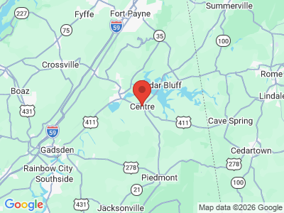
Comprising approximately 553 square miles, Cherokee County lies in the northeastern area of the state. Most of the county lies within the Valley and Ridge physiographic section, but the northeastern and northwestern corners lie within the Cumberland Plateau physiographic section. It is bounded to the north by Dekalb County, to the west by Etowah County, to the south by Calhoun and Cleburne Counties, and the to the east by Floyd, Chattooga, and Polk Counties in Georgia. The Coosa River runs through the southwestern corner of the county, and its tributaries, Little River and Terrapin Creek, intersect the area. In the 1960s, the Coosa River was dammed to create Weiss Lake, a 30,000-acre reservoir that stretches across the center of the county. The county's major transportation route is U.S. Highway 411, which runs east-west south of Weiss Lake. Other important routes include State Highways 9, 68, and 35. Centre-Piedmont-Cherokee County Regional Airport provides service for general aviation. Norfolk Southern Railroad operates the rail lines in the county.
Cherokee County Map
Comprising approximately 553 square miles, Cherokee County lies in the northeastern area of the state. Most of the county lies within the Valley and Ridge physiographic section, but the northeastern and northwestern corners lie within the Cumberland Plateau physiographic section. It is bounded to the north by Dekalb County, to the west by Etowah County, to the south by Calhoun and Cleburne Counties, and the to the east by Floyd, Chattooga, and Polk Counties in Georgia. The Coosa River runs through the southwestern corner of the county, and its tributaries, Little River and Terrapin Creek, intersect the area. In the 1960s, the Coosa River was dammed to create Weiss Lake, a 30,000-acre reservoir that stretches across the center of the county. The county's major transportation route is U.S. Highway 411, which runs east-west south of Weiss Lake. Other important routes include State Highways 9, 68, and 35. Centre-Piedmont-Cherokee County Regional Airport provides service for general aviation. Norfolk Southern Railroad operates the rail lines in the county.
Events and Places of Interest
 Cherokee County Historical Museum
Weiss Lake, with over 450 miles of shoreline, is known as the Crappie Capital of the World and hosts local, state, and national fishing tournaments. The Little River Canyon, one of the most extensive canyon and gorge systems in the country, is distinguished by towering cliffs, rushing Class V water, and scenic waterfalls. In 1992, Congress designated Little River Canyon a National Preserve, thus making it one of the cleanest rivers in the Southeast. The Little River also includes extensive fish populations, such as rainbow trout, redeye bass, catfish, and bream. In the southern part of the county, a small portion of the Talladega National Forest offers access to hiking and camping. Cherokee Rock Village (also known as Sand Rock) is a maze of sandstone rock outcroppings, boulders, and chasms at the southern end of Lookout Mountain overlooking Weiss Lake. Each October, county residents celebrate Sand Rock Day, featuring games, food, and live music, at the site.
Cherokee County Historical Museum
Weiss Lake, with over 450 miles of shoreline, is known as the Crappie Capital of the World and hosts local, state, and national fishing tournaments. The Little River Canyon, one of the most extensive canyon and gorge systems in the country, is distinguished by towering cliffs, rushing Class V water, and scenic waterfalls. In 1992, Congress designated Little River Canyon a National Preserve, thus making it one of the cleanest rivers in the Southeast. The Little River also includes extensive fish populations, such as rainbow trout, redeye bass, catfish, and bream. In the southern part of the county, a small portion of the Talladega National Forest offers access to hiking and camping. Cherokee Rock Village (also known as Sand Rock) is a maze of sandstone rock outcroppings, boulders, and chasms at the southern end of Lookout Mountain overlooking Weiss Lake. Each October, county residents celebrate Sand Rock Day, featuring games, food, and live music, at the site.
The city of Centre has numerous historic structures, including the Daniel House (c. 1830) and the Jordan House (1846). The Cherokee County Historical Museum, also located in Centre, contains artifacts and exhibits relating to the county's Native American, pioneer, and later history. Centre's Jon Pratt Memorial Park honors journalist and inventor Jon Pratt, who is known as the "grandfather of the typewriter."
The Avenue of Flags is a road connecting the cities of Centre and Leesburg that is lined with 306 flags honoring local veterans.
Additional Resources
- Heritage of Cherokee County, Alabama. Clanton, Ala.: Heritage Publishing Consultants, 1998.
External Links
- Cherokee County Commission
- Cherokee County Schools
- Cherokee County Chamber of Commerce
- Cheaha Regional Library
- Town of Cedar Bluff
- Town of Leesburg
- Town of Sand Rock
- National Register of Historic Places: Cherokee County
- Visit North Alabama
- Cherokee County Historical Museum
- Weiss Lake
- Little River Canyon National Preserve
- Talladega National Forest