The 1743 map depicts the original colonial-era size and location of Fort Condé in the town of in Mobile when it was controlled by France.
Fort Condé, 1743
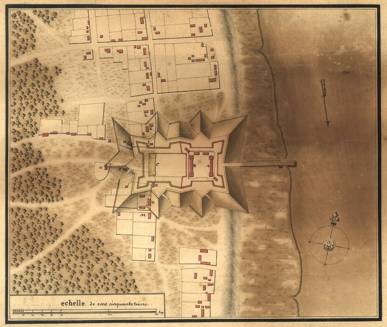
Photo courtesy of the Library of Congress, Geography and Map Division
Appears In