Fall Line
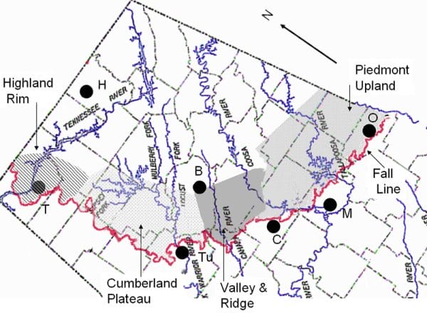
The geologic feature known as the fall line is the boundary between the East Gulf Coastal Plain and any of the provinces of the Appalachian Highlands Region. It runs in a curve from near Opelika in Lee County, tracks north of Montgomery, and then flows into Mississippi in the region west of Tuscumbia, in Colbert County.
 Fall Line
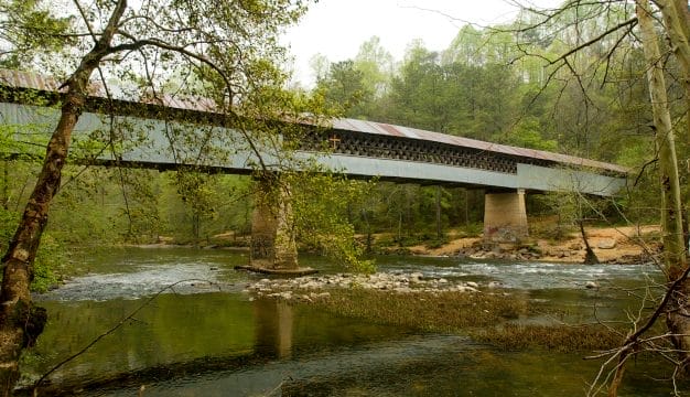
The term “fall line” was originally used to describe the east-facing cliff, called a scarp, that stretches from New Jersey south to the Carolinas and separates the hard Piedmont rocks of the Appalachian Highlands from the softer rocks of the Atlantic Plain. The fall line was important because the waterfalls and rapids along its length effectively stopped water transport inland, but they also provided power for water wheels and flumes. Hence, many of the early colonial-era cities, such as Trenton, New Jersey; Baltimore, Maryland; Richmond, Virginia; Raleigh, North Carolina; and Columbia, South Carolina, developed along the fall line. Several plant species live along the fall line, most notably the Cahaba lily.
Fall Line
The term “fall line” was originally used to describe the east-facing cliff, called a scarp, that stretches from New Jersey south to the Carolinas and separates the hard Piedmont rocks of the Appalachian Highlands from the softer rocks of the Atlantic Plain. The fall line was important because the waterfalls and rapids along its length effectively stopped water transport inland, but they also provided power for water wheels and flumes. Hence, many of the early colonial-era cities, such as Trenton, New Jersey; Baltimore, Maryland; Richmond, Virginia; Raleigh, North Carolina; and Columbia, South Carolina, developed along the fall line. Several plant species live along the fall line, most notably the Cahaba lily.
In Alabama, the fall line is not always a cliff or a scarp. From Opelika to Montgomery, where the hard rocks of the Piedmont meet the sands and gravels of the Coastal Plain, there is a visible change in slope, with the Piedmont rocks underlying a plateau that is 150 to 200 feet higher than the Coastal Plain rocks. Interstate 85 runs through the Coastal Plain and roughly parallels the fall line from Montgomery east to near Auburn. During the early nineteenth century, several small towns, such as Griffin Mill and Whatley Mill, sprang up in this area to make use of the water power produced by the local falls.
Between Montgomery and Clanton, the appearance of the fall line changes. It occurs as lowland, about 10 to 12 miles wide, that formed when all rocks were eroded by the power of the Coosa River.
In the central part of the state, the fall line is a zone about five miles wide that consists of narrow, steep-sided valleys with flat higher areas. The valleys of the Valley and Ridge section are generally underlain by the more easily eroded shale, limestone, and dolomite, and the rocks of the Coastal Plain underlay the higher elevations. In areas where the resistant Pottsville sandstone occurs, it forms the ridges, however, and the Coastal Plain rocks underlay the valleys.
In most of the northwestern part of the state, the fall line is a slope with an elevation change of about 120 feet and forms where the Coastal Plain meets the resistant sandstones of the Cumberland Plateau.