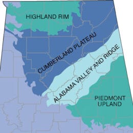
This map shows the districts of the Cumberland Plateau Physiographic Section. It is the southernmost reach of the Appalachian Plateaus Province, which stretches from New York State to Alabama. The section is home to significant coal deposits as well as important outdoor recreation areas associated with the Black Warrior River and Little River systems, including Little River Canyon and De Soto State Park.
Cumberland Plateau Districts
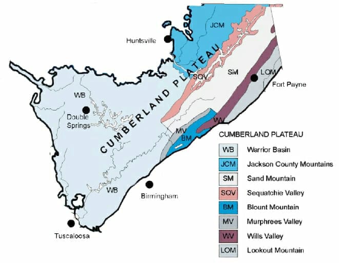
Photograph courtesy of the University of Alabama Cartographic Research Lab
Appears In